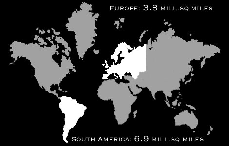
The
traditional map was devised by Mercator in 1569 in Germany. It shows Europe
larger than South America, which is almost double the size of Europe.
It places Germany in the middle, even though it is in the northernmost
quarter of the earth.